
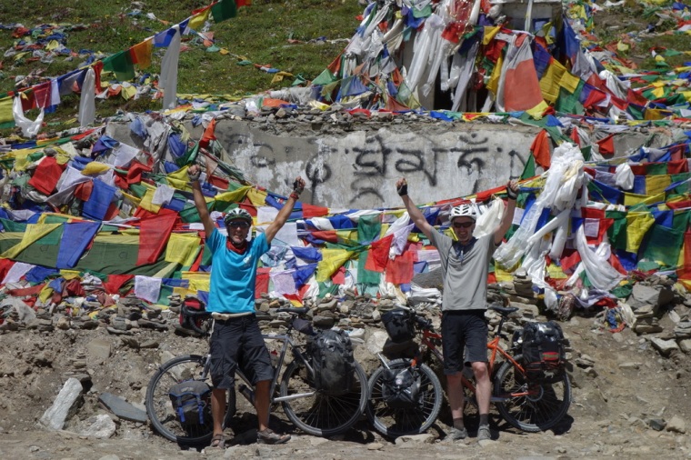
Introduction
The Spiti Valley is in the heart of the Indian Himalayas, close to the border with Tibet. Despite its remote location, it is possible to fit a cycle tour into a three-week vacation with a few days to spare for delays, detours and travel to and from New Delhi airport. The scenery is among the most spectacular anywhere in the world, but to see it you must ride on roads which push touring bikes to their limits. The location also offers incredible variety. The route passes through lush, fertile foothills, a sub-tropical valley, and high mountain deserts. In terms of culture, the tour starts and finishes in the fascinating cities of Shimla and Manali, and passes through regions rich in Hindu and Buddhist culture. Along the way, it is possible to make short side trips to temples, monasteries, and atmospheric villages.
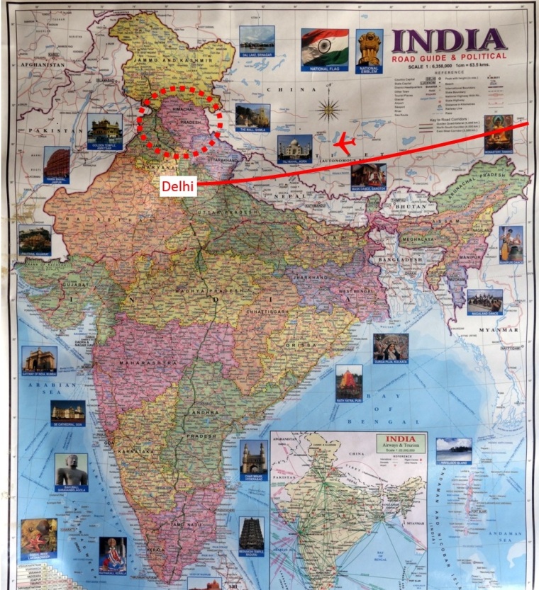
According to Laura Stone’s excellent guidebook, Himalayas by Bike, the route is 651 kilometres and takes 12 days. We added about 150 km with a few side trips, but still did it comfortably in the 12 days, with 2 days waiting for Inner Line Permits (ILPs). The distance we covered varied from 120 km on the good roads in Kinnaur, to 60 km on the steep, rocky tracks of Spiti. Although it is possible to do the tour without tents, the only accommodation on some parts of the route are dhabas (basic roadside shacks), which are often unappealing, and as we discovered on our last night, sometimes closed. We did the tour fully loaded, with front and rear panniers and bar bags, which meant we were prepared for all eventualities. At times, this made cycling on the rough roads really hard, but it also meant we could camp when necessary and gave us more comfort off the bikes. We did meet a few other people cycling the other way with just 10 kg of luggage each, so it is also possible to do the route light.
The Route
There are two ways to do the ride: clockwise from Manali to Shimla, or anticlockwise from Shimla to Manali. Himalaya by Bike suggests that the clockwise option is preferable as it gets most of the hard climbing over at the beginning, and offers tailwinds on the worst road surfaces. There is one big problem though, which is that the clockwise route does not allow enough time for acclimatisation. For this reason, we decided to ride anticlockwise from Shimla to Manali.
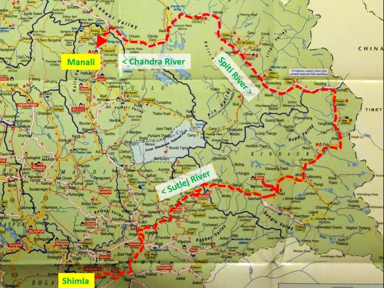
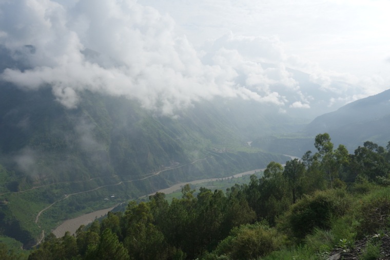
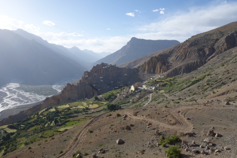
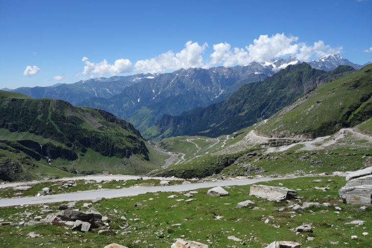
We started in Shimla, and then cycled all the way along NH22 via Narkanda, Sainj, Rampur, Rekong Peo, and Pooh. From Sainj to Pooh, the route follows the steep-sided Sutlej river valley. After Pooh, you leave the Sutlej to head north and later west along the Spiti River, taking in Nako, Tabo, Kaza, and Losar. After Losar, you cross the Kunzum Pass and drop down into the Kunzum river valley as far as the non-existent hamlet of Gramphu (Grampoo), where you join the Manali-Leh Highway and head south over the Rohtang Pass to Manali. The route takes in just two major passes, the Kunzum-la at 4550 metres and the Rohtang-la at 3979 metres. However, this belies the toughness of the route; there is a huge amount of climbing, some of it on very steep roads. On several days, you finish off with a big climb up to villages high above the valley floor. This can hurt! Including short side trips to Sarahan, Dankhar, Kibber, and Chandra Tal, we clocked nearly 800 kilometres.
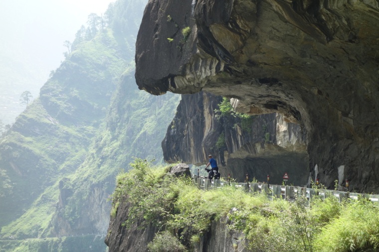
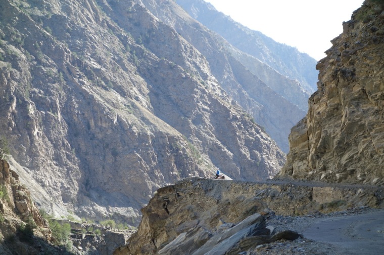
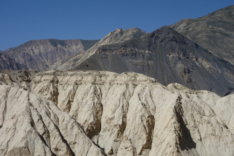
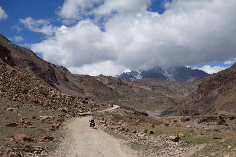
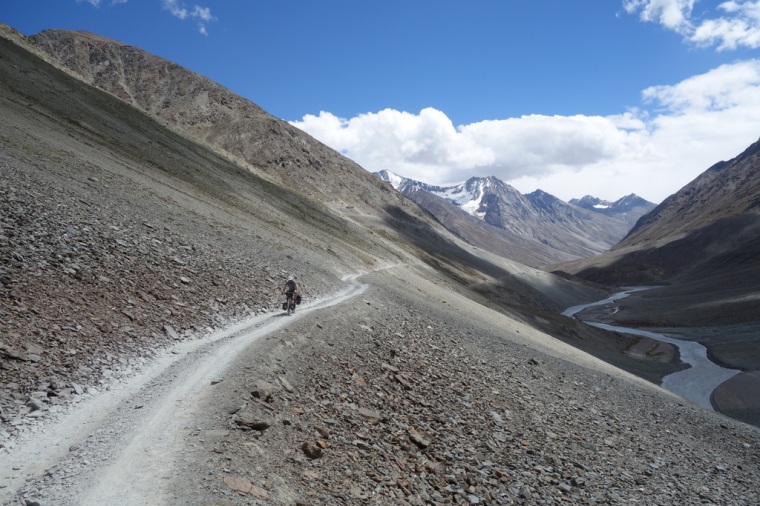
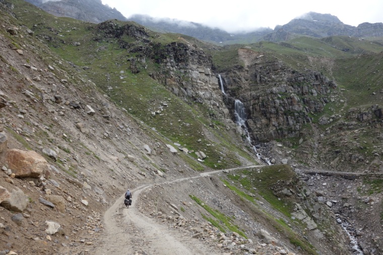
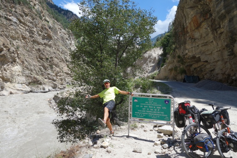 The World’s Most Treacherous Road! (photo JBL)
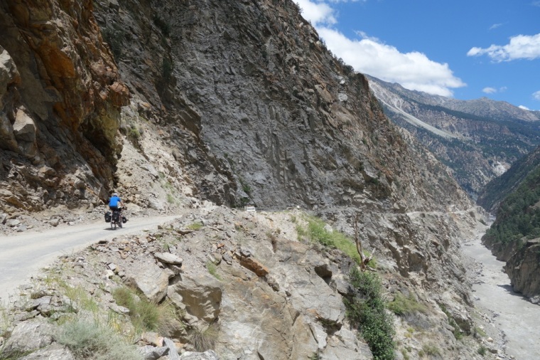
The road surface is good for the first two or three days, but then deteriorates as you progress up the Spiti Valley. The first part of the Sutlej valley is on good asphalt, but after Tapri, 30 km before Rekong Peo, the road deteriorates due to landslides and resurfacing work. In February 2015, a huge landslide blocked the road, and a 23 km detour takes you high up the valley side and then straight back down to the river. From this point onwards, there is a mixture of new asphalt, old broken asphalt, and dirt all the way up the Spiti Valley. 30 km before Losar, near the head of the Spiti Valley, the asphalt finally peters out and doesn’t reappear until the Rohtang-la. The Kunzum-la road is very rough and rocky on both sides, but especially rough on the north (fortunately our downhill) side. From Batal, at the foot of the Kunzum-la, to the foot of the Rohtang-la, the road is often really rough and rocky, with numerous shallow rivers flowing across it. The climb up the north side of the Rohtang-la is mostly dirt, but it was dry on the day we did it, so it was not too bad. In rain, it can be terrible. In 2012 we descended the Rohtang-la in monsoonal rain on our Manali-Leh ride, and I wore out a new set of brake blocks and scoured my rims on that single descent. However, things have changed since then as the road seems much better now. The north side of the pass is now almost all good asphalt, which was a wonderful surprise for us.
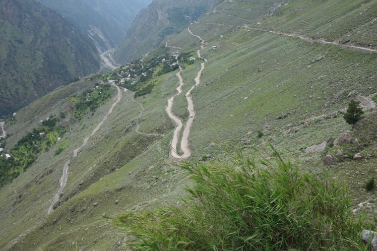
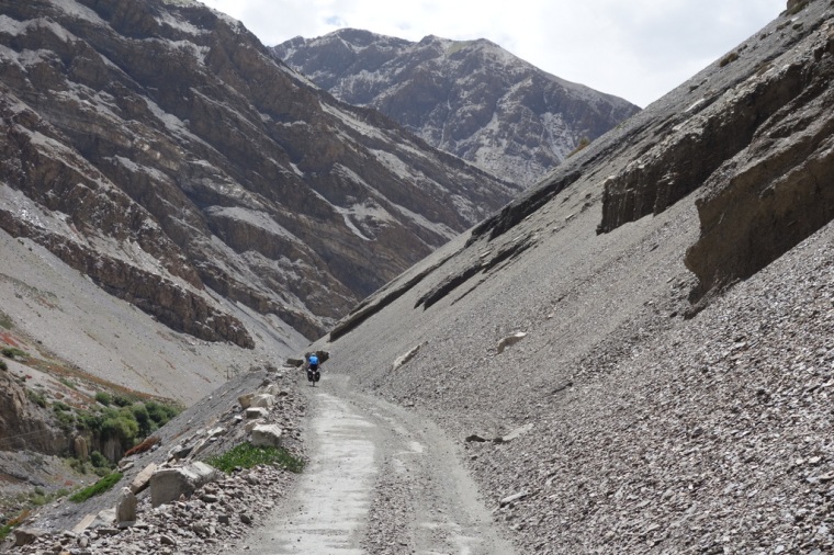
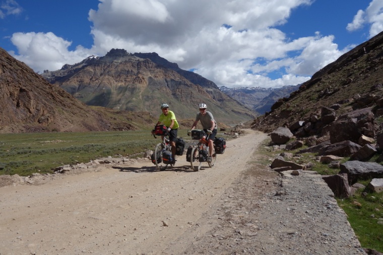
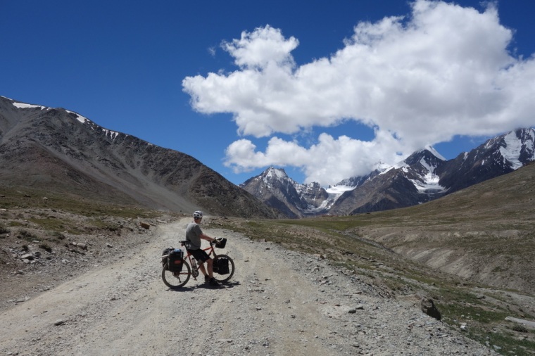 Climbing up to the Kunzum-la
So which direction is best, Manali to Shimla, or Shimla to Manali? Unlike Laura Stone, we would suggest anticlockwise from Shimla to Manali. There are several advantages. Firstly, you start the ride on very busy roads, passing through one chaotic town after another. Over the next three days, the traffic gradually thins out, and then after Rekong Peo you finally get away from it all. Likewise with the scenery. Before Rekong Peo, you are in agricultural land with people and buildings dotted all over the hillsides. After Peo, you finally get to the real wilderness. Gradually moving into the remote mountain areas feels much better than finishing off the ride with 3 days of increasing traffic and urban development. The weather also improves as you head out from Shimla. The monsoon gets as far as the Sutlej river, but not the Spiti. We had showers on the first three days, but throughout Spiti it was dry. On the penultimate day in the Chandra valley we got an hour of heavy rain. Laura’s book suggests that the prevailing winds blow from the west down the Spiti Valley, but we actually had tailwinds all along the Sutlej valley, and then all along the Spiti valley to Losar. Somehow, the winds followed us eastwards, northwards and then westwards all the way to the foot of the Kunzum-la, where they reversed and blew with all their might into our faces as we climbed and descended the pass. However, as we were going so slowly, it didn’t seem to make much difference.
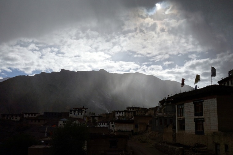 Stormy skies, Kibber Village
The road surfaces also favour the anticlockwise route. Our ascent of the Kunzum-la was definitely much easier than the opposite direction, and we tackled the worst road surfaces along the Chandra river from Batal to Grampoo downhill. Riding anticlockwise also allows you to acclimatise gradually, so we suffered no headaches or other ill effects from the altitude. We met several people riding clockwise, and they were all struggling with the altitude or the bad road surfaces on their climbs. Finally, riding anticlockwise leaves the most spectacular scenery and the most beautiful villages to the latter part of the ride. Staying in Nako, Dankhar and Kibber villages, and camping above the Chandra-tal were highlights of the trip.
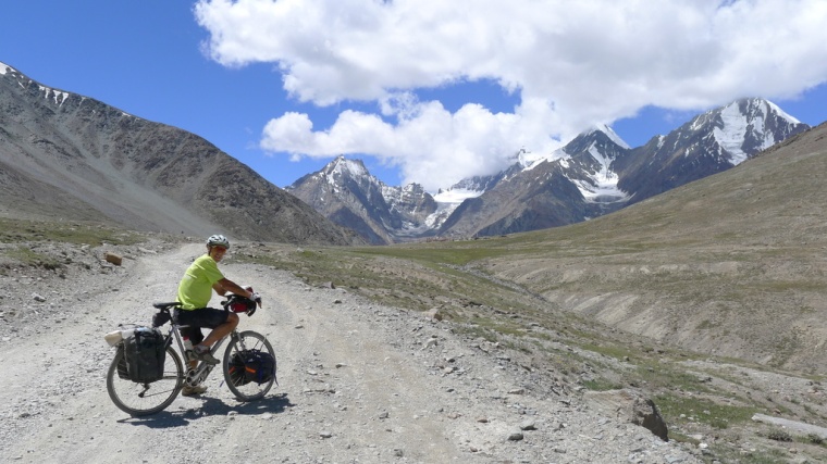
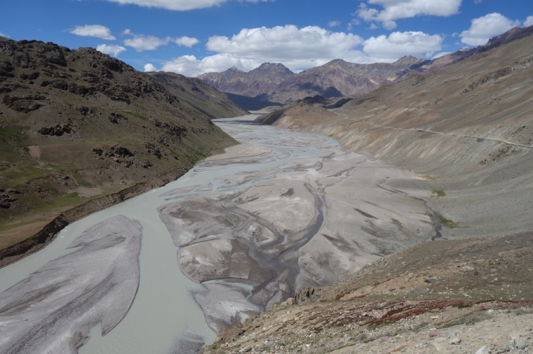
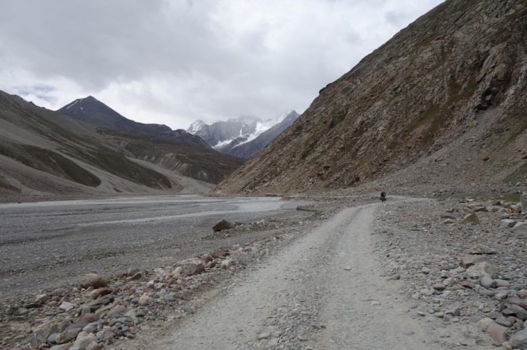 Along the Chandra River
Getting There
John and I arranged to meet at the Ajanta Hotel in Delhi. We had stayed there before and they are very reliable about airport pick-ups, taxis to stations, and so on. I flew Air India from Tokyo and John came from Paris by BA. We spent a night at the Ajanta and then arranged for two hotel staff to come with us in the taxi to Delhi railway station to help with our bike boxes. This cost 200/- per box, but it saved a lot of hassle with porters. They took us right to our carriage on the Shatabdi Express to Kalka, which made things very easy. They even helped us find a place for our boxes on the train; the overhead luggage racks are huge, so we managed to just about get them right above us. It is well worth getting to the train thirty minutes early to find a place for the bikes.
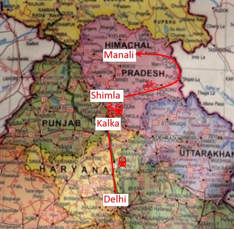
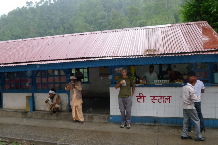
The journey to Kalka takes 3.5 hours and if you travel AC Chair class you get free breakfast, fruit juice and tea. It is all part of the experience. At Kalka, we just had to drag our boxes 100 metres to the waiting Himalayan Queen train which takes you the 90 kilometres up the mountain to Shimla. The journey is over 5 hours complete with numerous long stops to get tea from station vendors. It is the third time I have done the trip but it is still a wonderful journey winding up the tree and flower lined route with grand vistas of cloud smothered mountains. But after 5 hours you are ready to disembark.
 Tea Break on the Kalka-Shimla Mountain Railway (photo JBL)
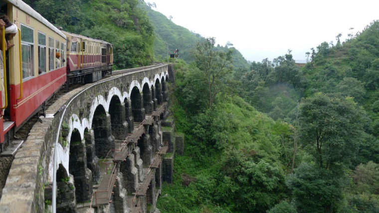 The Himalayan Queen (photo JBL)
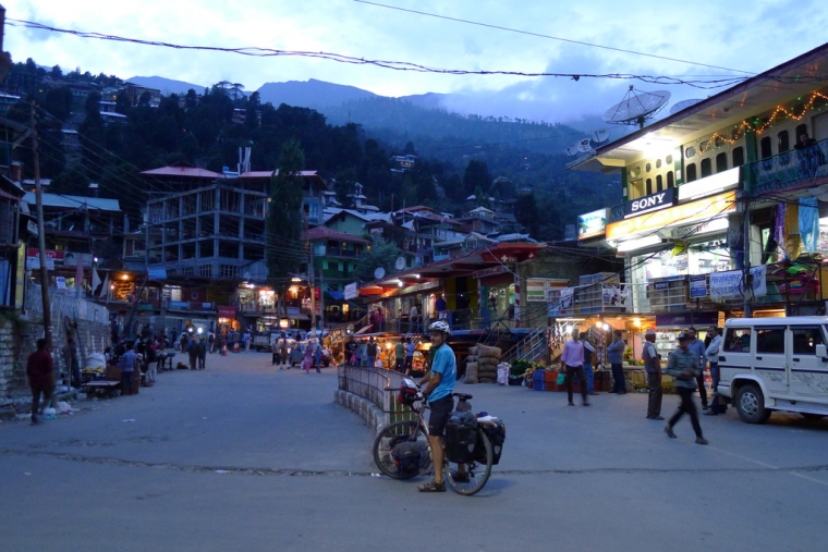
Shimla station is not as chaotic as others, and it has a very smooth platform which to drag bike boxes across. However, you have to climb a very steep slope to exit the station to the taxi ranks. There you have to search for the man with a clipboard to organise your taxi. We were the last people off the train so he drove us to our hotel himself for the very reasonable fare of 450/-.
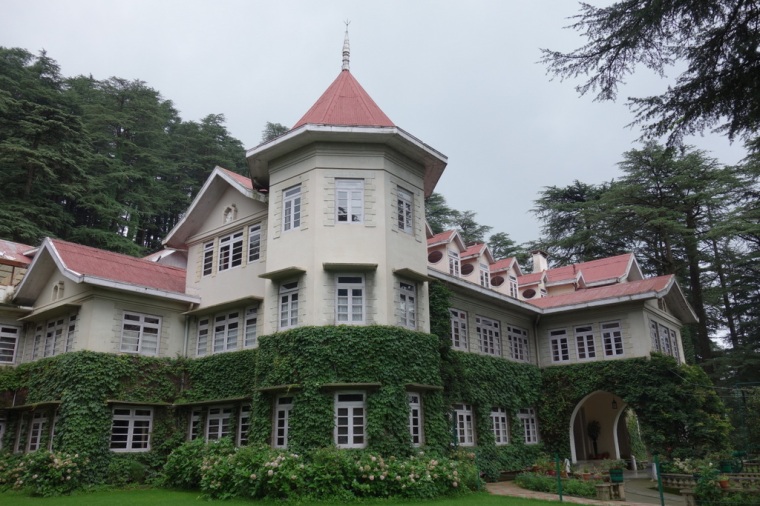 The Woodville Palace Hotel
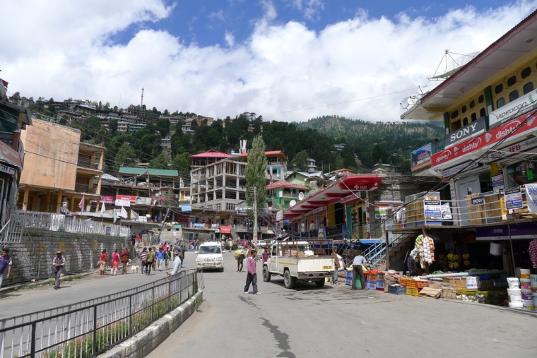
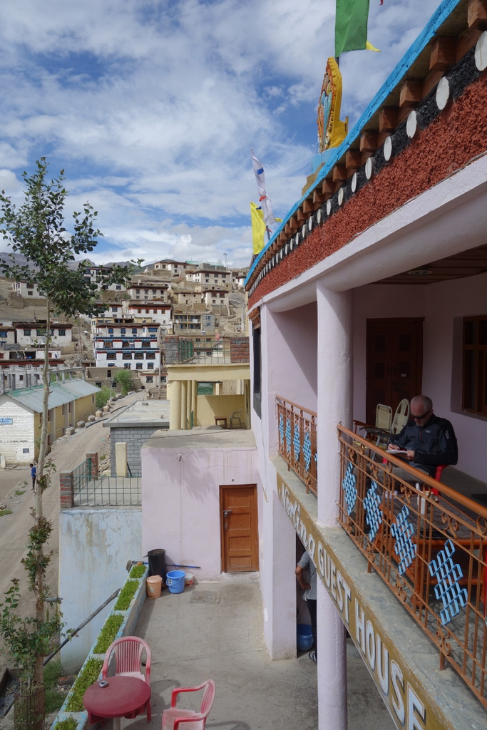
We stayed at the magnificent Hotel Woodville Palace which was our last bit of luxury before we headed into the mountains. It felt a bit strange arriving with our bikes and tatty panniers, getting saluted and then escorted to our rooms by uniformed staff. Later we sat in the splendid dining room in our cycle gear, surrounded by framed black & white photos from the days of the Raj. The next day we wandered along the forest roads into Shimla to do some last minute shopping and to promenade with thousands of others along the Mall.
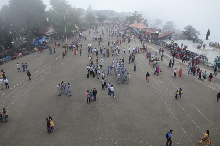 The Mall, Shimla
The main thing to buy was some medicine – antibiotics, diarrhoea medicine and rehydration salts – from Jai Bharat Medical Store in Lower Bazaar. India is awash with counterfeit medicine, so we had been recommended the Jai Bharat by friends. The antibiotics were for giardia, dysentery, and other potential water-borne diseases, while the rehydration salts would be useful for adding to purified water to keep us properly hydrated. Three years earlier we had suffered headaches from drinking purified water without added minerals; we had easily cured this by adding rehydration salts.
In the afternoon we took shelter from a heavy downpour in a coffee shop. 25 years ago the only coffee shop was an ancient coffee house where you were served southern Indian coffee by plumed and turbaned waiters. This time we sipped cappuccino in a slick modern bar with TV screens blaring out pop music. It was simultaneously reassuring and depressing that India was moving so rapidly with the times.
The Ride
Wednesday 12th August. Day 1: Shimla to Narkanda
 Setting off
Fuelled by huge quantities of jam and toast for breakfast, we set off from the Woodville Palace at 8:20 a.m. beneath a heavy sky. The first three kilometres involved contouring along the forest road until we got to National Highway NH22 which we would follow all the way to Spiti. It was busy with early morning traffic heading to and from the small towns and villages which reach deep into the mountains of Himachal Pradesh. The first town we came to was Sanjauli, its multi-coloured buildings spilling down the hillside like a smaller version of Shimla. We cycled through a stream of pedestrians heading to work and school, and then on to Dhalli where a dark tunnel cuts through to the far side of the ridge. From there the road contours high along ridgetops alternately covered with giant cedars and slightly haphazard apple orchards. At times you leave civilisation and the road becomes almost quiet, but then you are plunged back into the chaos of another town with honking trucks, buses, Marutti Suzukis, and motorbikes jostling for road space. Pedal-powered vehicles are way down the pecking order. It is hard to imagine how so many people can make a living so high up in the steep foothills of the Himalayas. Despite all the vehicles, it was mostly pleasant riding with dramatic glimpses of green mountains cloaked in mist. Most cars and trucks gave us a lot of space; it is just necessary to keep wide awake and well aware of the erratic behaviour of a few less considerate drivers.
The road climbs and falls, climbs and falls, so it was hard work for our first day out on the road. We climbed a total of 960 metres, and due to numerous stops, we only covered 60 kilometres. We were slowed by thick fog and drizzle in the morning, and lots of bumpy sections with occasional road repairs. It was cold enough to wear an insulated gilet and Goretex jacket on descents, but warmed to 22 degrees in the early afternoon. At noon the cloud lifted and eventually blue sky poked out from the clouds as we rode along snaking ridges with fine views of terraced slopes. Alongside the road, trucks were parked up waiting to take on loads of apples at the numerous depots.
 Narkanda
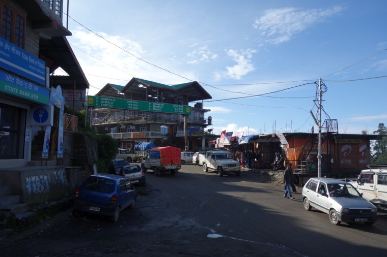
We arrived in Narkanda which sits high up on the ridge before the NH22 starts its 2,000-metre descent to the Sutlej river. Due to the cool air and heavy mist we decided to stay in Narkanda and hope for fine weather the next morning so we could better enjoy the descent. The village itself is a typical noisy settlement with little appeal, but a small track on the right leads up to the Himachal Pradesh Hatu Restaurant, a state-owned guesthouse perched up on a quiet knoll. There was unfortunately noisy construction work going on, but it was still a lucky find: clean rooms, good food, and a pleasant garden with views across the mountains. After the expense of the Woodville Palace, the 1900/- for a spacious room seemed cheap; further along the road we would find similar rooms for 500/-. We received one interesting piece of information from the manager. He told us that we could get Inner Line Permits at Rampur which would make things much easier for us. We would get up early the next morning and aim to arrive there for lunch.
Day 2: Narkanda to Sarahan
 Descending through giant firs
It is never good to make fixed plans when cycle touring. In fact, one of the things I love most about touring is not knowing where you will end up at the end of each day. Our plans to get ILPs in Rampur and then ride to Spiti as quickly as possible soon had to be revised. Rampur did issue permits in the past, but now they are only available in Shimla or Rekong Peo if you are doing the route anti-clockwise. If we rode like mad, we might get to Rekong Peo by Friday afternoon, but it would be hard to get there before the office closed at 5 p.m. Apparently the office is open some Saturdays, but we didn’t know which ones. It seemed that we might have been better to spend an extra day in Shimla to get ILPs there, but since the permit is only valid for 7 days from the date of issue, we would have had to ride like mad for 6 days to get to the far side of the Inner Line. It seemed that we had just timed things badly. This became even clearer when we later learned that Saturday 15th August, the day we had hoped to get permits in Rekong Peo, was Independence Day! We would not be able to get ILPs until the Monday, which gave us 4 days to cover 2 days’ worth of riding. With our main purpose being to ride in Spiti, it was frustrating to ‘lose’ two days in Kinnaur. It is at this point that you need to take a step back and just enjoy the time you have in an area. We did this in great style but changing our destination to Sarahan.
 Entering the Sutrej Valley
The day had started really well with the huge descent into the Sutlej valley. The road falls through a magnificent ancient cedar forest from Narkanda at 2625m to Sainj at 835m. As we rolled down the snaking, often bumpy road, the weather changed from the damp misty cool of a mountain morning to the burning heat of a day in the sub-tropics. We paused briefly at Sainj for a breakfast of toasted jam sandwiches in a decent hotel restaurant, and then started the long steady climb up the Sutlej River. We passed through Nirath, New Nogli, Rampur, Kaneri, Jhakri – the whole way accompanied by the roar of engines and the blare of horns. Every vehicle sounds its horn which is more than a bit trying when the road is busy. It is impossible to get used to, especially when the driver leaves it to the last minute to blare his (it’s always a man) souped-up mega klaxon. Fortunately, most vehicles leave you plenty of space, except for when some crazy fool tries to overtake a truck just as it is passing you, while another is coming in the opposite direction. But it tends to be in slow motion with time for you to bump yourself off the road.
 Lush, humid Sutrej Valley
The scenery is impressive but not yet spectacular. The valley rises steeply and steadily from the river up to mist-shrouded peaks, changing on the way from banana plantations, to apple orchards, to coniferous forests. By early afternoon the temperature had reached 34 degrees so we stopped just after Rampur for an ice-cold Limca, and then headed our again into the sun. We passed a huge hydro project and several good-looking hotels. The road forked two or three times, and at each fork the traffic thinned somewhat and the noise levels declined.
In Jhakri, 12km before Jeori, we spent an hour eating lunch and pouring over maps trying to decide whether to push to Recong Peo the next day. If we could get to Peo by mid-afternoon, we’d be able to get the ILPs and head straight to Spiti. In the end, we decided to ride up the valley side to Sarahan and forget about the permits till Monday. This turned it into one of the longest, hardest days of cycling I’ve ever done. The Sutlej valley road constantly rises up to villages and then drops back to the wide muddy torrent. The road is asphalt, but not the smooth surface I am spoilt with in Japan; it is rough, bumpy tarmac which gradually wears you down. At 4:10 we gratefully left the main road and headed up the 715m climb to Sarahan. The road winds up through villages and farms for 17 interminable kilometres. It is the kind of cycle touring which requires grim determination and the certain knowledge that you can indeed make it. We took two or three breaks where I drank a bottle of water thick with rehydration salts. I think this saved me; that and the numerous delicious bananas and apples I ate along the way. Finally the gradient became kinder and we traversed around into Sarahan. We’d ridden 40 kilos of bike and luggage for 10 hours in the blazing sun.
 Riding up to Sarahan
Day 3: Sarahan
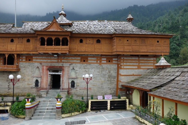
The Temple Rest House – or rather guesthouse – in Shree Bhima Kali Ji Temple forms one side of the temple courtyard which is a serene place dominated by the stone and carved-wood temple with its turreted stone roofs sweeping down in curving pitches. Flowers skirt the quadrangle – marigolds, roses, cosmos. An occasional bell tolls, schoolgirls in white and pink shalwar kameez, red cardigans and white sashes stop and touch the temple steps. Behind the roofs, mountain slopes covered in tall firs rise up to the clouds. It is intoxicatingly atmospheric. The frustrations of unattainable permits had led us to this wonderful place. It is a lesson to learn and remember.
 View from Our Room
After we had checked in to the guesthouse the previous evening, we wandered down the single main street and settled on a simple dhaba for the one thing on the menu: a plain thali. In the next-door shop we found bottles of delicious locally-pressed apple juice to go with the meal. There is not much to the village of Sarahan but it is a laid-back place and the streets are surprisingly free from rubbish. It is very different from the other places we had passed on the way to get there.
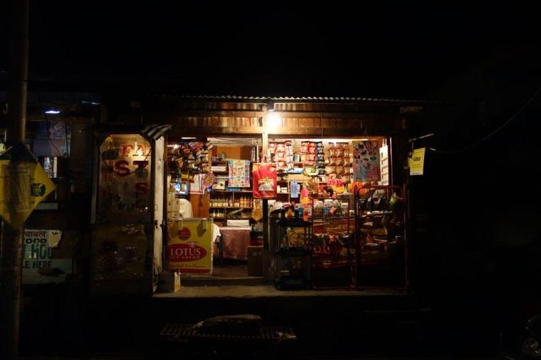 Grocery Store in Sarahan
It started to rain in the evening, and by the next morning it was pouring down. I sat on the veranda looking through a curtain of raindrops at the occasional visitor to the temple. It was another good reason to spend the day in Sarahan. After a breakfast of chai and bread we took a leisurely walk up behind the village, past a number of elegant wooden houses, and up through apple orchards. As we climbed a steep, slippery rocky track, men with huge baskets of apples descended sure-footedly in sandals. It was a sharp contrast to our time of leisure. Finally the track ran out at a house with an angry dog, so we retraced our steps a way, and then sat looking down on the panorama of terraced hillsides, distant snowy peaks, and Sarahan far below. I wondered how we could have even considered not riding a mere 700m up to this place.
 Shree Bhima Kali Ji Temple
Sarahan was the first place where we got a taste of the Tibetan culture we would find further along the route. For lunch we dined on our first plate of vegetable momos – boiled, stuffed dumplings; many more plates would follow in the days to come. After that we visited the inner buildings of the temple, walking barefoot on polished stone floors, staring up at the intricate wooden carvings smothering the twin towers. It was all a bit too relaxing; by mid-afternoon I was itching to get going again.
Day 4: Sarahan to Recong Peo
We’d spent the previous evening trying to decide whether to ride fast to Recong Peo to get our ILPs, or to take a 42 km side trip up the supposedly beautiful Sangla Valley. It is easy on a cycling trip to slip into the mindset of always trying to get to the next destination, but often the best experiences are when you forget where you are heading and just let things happen. So we decided to put Spiti back a day or two and instead head off the main road up to Chitkul high up in the Sangla Valley.
The day didn’t start well. I discovered that my trip computer had been stolen from my bicycle which was locked up inside the temple courtyard. It was a shame as it was new and had an altimeter which is useful in the mountains. The guesthouse manager had said that we couldn’t take the bikes inside, but this showed us that we need to insist that the bikes go into the rooms with us. However, it was fortunate that more things hadn’t been stolen, such as tools or even wheels. From this point on, we insisted that our bikes go everywhere with us.
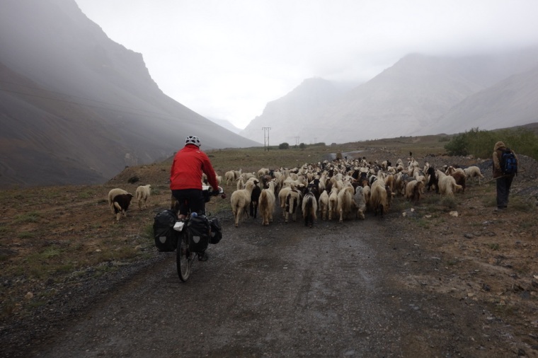
We cycled back down to Jeori in the valley floor where we planned to have breakfast. However, due to Independence Day, the best we could find was bread and juice. The good news was that the road after Jeori had far less traffic, which made for pleasant riding. Although the river is not steep, the road repeatedly climbs high up the valley floor, before plunging back to the water’s edge. Gradually the valley sides steepened until we were riding in a deep gorge which was truly spectacular in places. One section of road was cut straight into the vertical rock face, just a small notch in the massive rock slab. It was an incredible piece of road. Then as I rode around one corner, a huge bird flew right across the front of my bike and then soared up over the river. It was a vulture which had been feasting by the side of the road on a dead cow. For several minutes we watched four vultures circling gently over the road, hoping they would come back to resume their meal.
 Building a road into a vertical rock face
From there on, the road deteriorated to smooth dirt with occasional rocky sections where scree had been bulldozed off the road. At Tapri we had lunch at a typically basic little dhaba, but the thali they served was delicious and very cheap – just 140/- for two including two mango juices and two bottles of water. It was only our fourth day on the road but we were already becoming used to eating in places with somewhat dubious standards of hygiene. But as long as we could wash our hands and the food was piping hot, we were happy. We avoided anything uncooked, chose busy places where possible, and used hand sanitiser before eating anything. This seemed to work as we stayed healthy for the whole ride.
The owner of the dhaba informed us that the road ahead was blocked and that we would have to take a 23 km “bypass”. We didn’t learn much more than this, so we left Tapri hoping that his information might be wrong. A detour could only mean climbing up the mountain side as there was nowhere else to go in the narrow valley bottom. Unfortunately, the information was correct. A few kilometres out of Tapri, the road was indeed closed, and we were directed to climb up a steep road heading way up the valley side. After a few hundred metres we were stopped by a man with a smartphone and a red flag. Apparently we would have to wait for rock blasting. Our long, slow ride to Recong Peo was becoming much longer and much slower. We settled into a long wait and reflected on the time 3 years ago when we were nearly hit by flying rocks on the Rohtang Pass. We hadn’t understood the significance of the red flag that time, so we rode past the road block and nearly suffered the consequences. A huge blast had sent rocks flying in the air between us as we cycled for our lives. This time we understand the value of patience, and settled in for a long wait. Eventually, the blasts went off, smoke and dust rose into the air, and we could continue.
 23-kilometre detour
It is hard work riding up zigzagging climbs in the Himalayas, especially when you know it is not in the direction you are supposed to be going. However, as is so often the way with these things, we had an unexpectedly pleasant experience along the way. At the top of the climb, we came upon two policemen and a local man who stopped us for a chat. They were full of praise for our efforts and gave us their names and contact details in case we had any difficulties. One of them even asked me for my opinion on Chris Frome’s recent victory in the Tour de France! We took photos and then they sent us on our way with smiles and handfuls of apples.
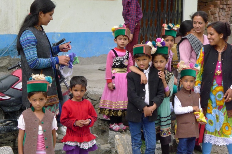 Dressed for Independence Day (photo JBL)
No sooner had we got to the top of the climb than we were winding all the way back down into the valley. The road was rough and bumpy and twice my rear pannier fell off. It turned out that there was too much play between the pannier hooks and the rack, something I’d need to fix later. Back down in the valley floor, the main road had turned into a sandy track which meant progress was hard and slow. By the time we reached the turn-off to the Sangla Valley, we were exhausted and in no mood to start the long climb up to the nearest town, Sangla, 17 km away. We could have taken a taxi but that seemed like a defeat after all our hard riding, so reluctantly we decided to head for Recong Peo instead.
 Exhausted in Powari
The road continued along the mud-filled river but was mostly unmetalled and very rough. It took us an age to get to Powari, dusty, exhausted and still facing the 300-metre climb up to Peo at 2293m. Fortunately, the steep twisting road was at least metalled, otherwise I’m sure we would have walked. We finally arrived at 7:15 p.m. relieved to be able to get off the bikes. It was a shock to leave the quiet of the valley and enter the mad chaos of Peo, car lights dazzling us in the unlit main street and trucks honking at the mass of people celebrating Independence Day. The recommended hotels were all in the busiest part of town, so we headed up the street to the drab Jeevan Joti guest house which was at least quiet. More importantly, they let us carry our bikes up the steep, winding staircase to our rooms.
 Arriving in Recong Peo (photo JBL)
We walked back down into town to look for a place for dinner. Peo enjoys all the chaos of an ordinary Indian town: trucks revving engines, buses reversing into crowds, cows feasting on piles of rubbish spilling out of a skip. We found refuge in a smart restaurant with the unlikely name of Little Chef. It was a lucky find as we would spend the next 36 hours waiting for the ILP office to open.
Day 5: Sunday Rest Day – Recong Peo and Kalpa
 Recong Peo
After the rigours of the previous day’s riding, we enjoyed a slow start to the day. We wandered down the empty streets of Recong Peo in search of breakfast, but inevitably ended up in the comfort of the Little Chef. We met up with two Israelis who were also waiting to get their ILPs on Monday morning. They gave us a few suggestions for places to visit in Spiti, including the must-see village of Nako and a side trip up to Dankhar where there is a beautiful mountain lake. Apparently Spiti is very popular with Israelis who share their experiences with one another.
 Prayer Wheels, Kalpa
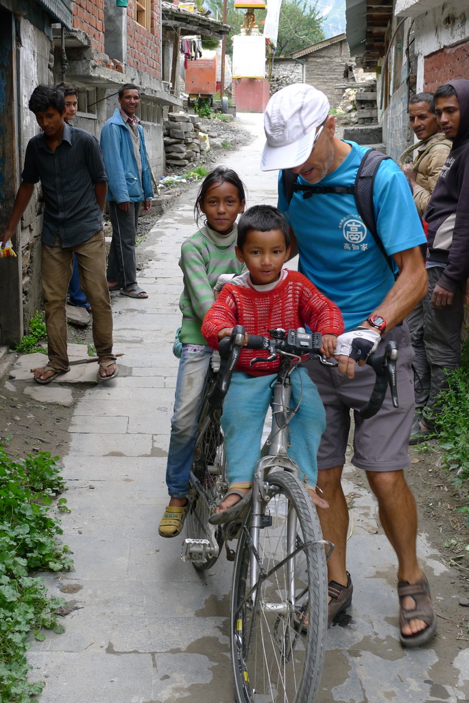
Later in the morning we cycle further up the valley side to the highly recommended village of Kalpa. It is a pleasant ride up a steep, narrow, bumpy tarmac road to the village, past frightening roadside butcher huts, to the village which is a mixture of Tibetan and Hindu culture. There is simple Buddhist temple and a somewhat more ornate Hindu shrine, but Kalpa is rather underwhelming. The best part was having little kids climb all over our bikes, and then pushing them screaming up and down the narrow streets.
 Kalpa Kids (photo JBL)
Back in Peo, we did some minor repairs on our bikes. To solve the problem of my panniers falling off on bumpy descents, I bought some plastic pipe and taped it to my rear carrier to give the hooks a nice tight fit. It mostly stopped the problem, but once the roads got really rough in Spiti, I was forced to use removable zip ties.
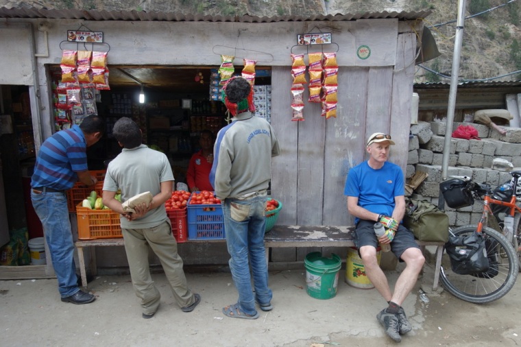
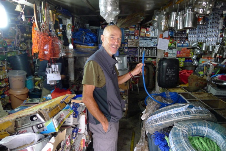 Buying Bike Spares (photo JBL)
The rest of the day dragged by, but at least the hotel had a rooftop terrace where we could sit and read and watch the sun set magnificently on nearby mountains. We finished the day back in the Little Chef where we filled up with aloo mattar in preparation for the hard ride ahead.
 Evening View across Recong Peo
Day 6: Recong Peo to Pooh
After all our worry about getting the ILPs, it all proved very easy. We went to one of the handful of private travel agencies just by the police station. We filled in a form, handed over 350/- and were taken to the ILP office where our photos were taken. We did need photocopies of our passports and visas, but nothing else. There was no talk of needing 4 people, and I don’t think they would notice if you were alone as the travel agent applies for several people at once.
Forty minutes later, we returned to our hotel, loaded up the bikes, and sped back down to the main road. That was the fastest we moved all day. The so-called main road was often little more than a dirt track, covered in places by recent landslides. There were short stretches of fresh tarmac, but mostly we rode on old asphalt pockmarked and cratered by rocks, or on long stretches where the mountain was rapidly reclaiming the road.
 Leaving Lush Kinnaur
We had planned to stop for lunch at Akpa, but the dharba there was really grim, so we pressed on to Jangi to look for something better. At a steel-trussed bridge over the roaring Sutlej we met a Basque cyclist coming the other way. He had ridden alone from Srinigar and was heading for Nepal. He gave us a worrying report of the roads we were about to take, telling us we needed a ‘strong head’. It seemed we would have some interesting challenges in the days ahead.
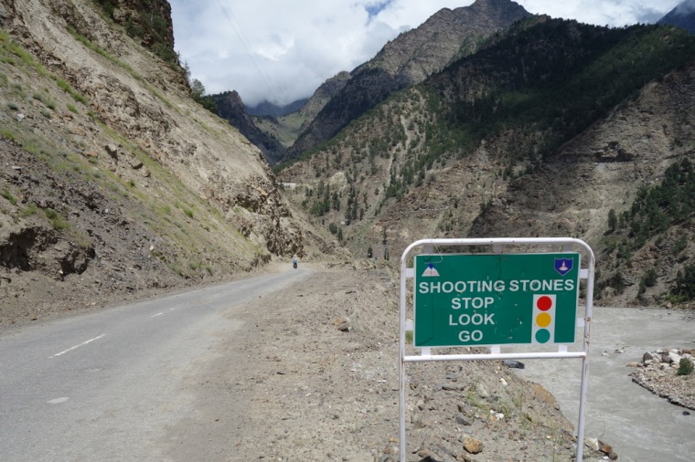 Shooting Stones
We wore our helmets all day due to many sections marked ‘Shooting Stones’. At one place, there was a policeman at a very active landslide who warned us to ride very quickly as scree was continually rolling down on to a fan of rubble across the road. I went first and then tried to film John through a fit of giggles as he cycled like a man possessed across the slide. Later it was much less amusing when a rock landed with a rifle-crack between myself and John who was no more than a metre away. From that moment on, we wore our helmets for the whole trip.
Jangi was no more appealing than Akpa, with most of the town on the far bank of the river. So we rode on to Spillow with a very welcome tailwind, getting there in time for a late lunch. Strangely enough there was another branch of the Little Chef, but with nowhere to leave our bikes safely we opted for a tidy little place with outside seats. Now we were well away from towns, everything was cheap. Our bill for two thalis, a few bottles of water and two mango drinks was 250/-. In the end, we probably spent more in a day in Chandigarh or Shimla than in a week in Spiti.
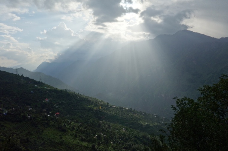
The last 25 kilometres or so to Pooh was fine going at first, with a good surface and a strong tailwind, but after 15 km the road turned to loose gravel. It was really hard work, but the views more than compensated. All of a sudden we found ourselves in the magnificent, wild, arid landscape of the dry Himalaya. We hadn’t expected to see such scenery until Spiti. Instead, in just 50 km from Peo it had transformed from lush forests and farms climbing up to the forested ridges, to orange and pink and brown slopes dotted with scrub. In places the river cut through deep gorges, while all around snow-streaked peaks soared above us. The clouds that had covered the mountaintops and constantly threatened monsoonal deluges, had thinned to wisps in the deep blue sky. It felt like we had moved suddenly from cycle touring to a full-on adventure.
 Pooh
Pooh
Pooh is perched 300 metres above the road, reached by another winding tarmac lane. It was a steep climb up but very worthwhile. A kilometre or so before Pooh proper, there is a small cluster of shops and the surprisingly excellent Om Guesthouse. After much confusing negotiation, we got a clean, comfortable room with a balcony overlooking the whole valley and peaks beyond. It was a little more than we had been paying, 800/-, but worth much more to us. Even better, on the second floor there is a huge marble-floored terrace with incredible views. We sat until sunset with our chais, mesmerised by the stunning panorama. The restaurant was also impressive, but not so the promised wifi which failed to deliver a connection.
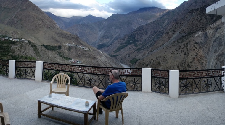 Om Guesthouse Terrace Panorama
Day 7: Pooh to Nako
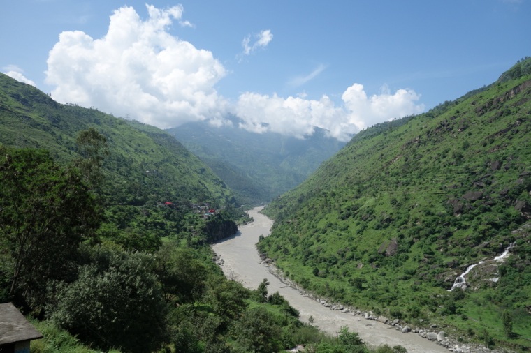
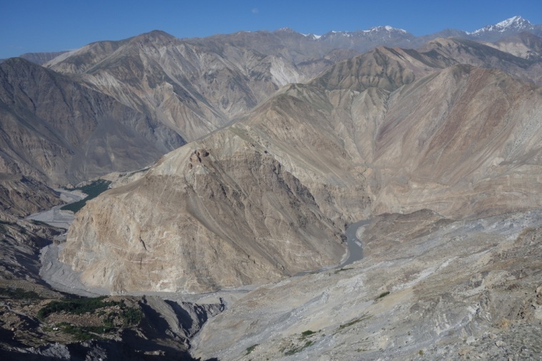
While the ride from Recong Peo to Pooh took us from lush farming to arid scrub, the next day from Pooh to Nako took us in just 41 km into a lunar world of soaring mountain deserts dotted with Tibetan villages. We left the Sutlej River which flows from further east in Tibet, and joined the Spiti River as it cuts through a deep narrow gorge. The road hangs above the Spiti, cut into the rock face, which is an appropriate gateway to this other world.
 Riding through Pooh
From the Om Guest House, we continued up the steep road that had brought us there the previous evening as I wanted to see the village of Pooh, and we could cut across to the main road without retracing our tyre tracks. It turned into a longer, steeper early morning climb than I’d thought, but it was worth the effort to ride down through Pooh’s narrow streets as schoolchildren climbed up to their school. We then freewheeled through a military base where we chatted to officers who seemed unconcerned that we had somewhat stretched the scope of our ILPs (it is always important not to read the small print). We then rejoined the NH22 and continued descending until the bridge at Khab, which at 2618 m meant we would have over 1000 m of climbing to Nako, our longest single climb of the trip.
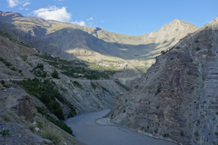
 Entering the Spiti Valley
At the fork in the river, we looked up the Sutlej river to a spectacular snowy mountain in Tibet. It was tempting to take photos, but with concrete pillboxes dotted around, we thought it best to obey the rule about not photographing bridges. We’d bought 3 litres of water at Pooh, but it wasn’t enough. With only a potato parantha for breakfast, we badly needed a shop or dhaba. Unfortunately, there was nothing until a few kilometres from Nako, apart from one closed dharba in Ka. Despite our thirst, the climb up from the river to Nako was perfect. Good tarmac, a reasonable gradient, little wind…and scenery to die for. There are actually two sets of loops to climb, both at about 7%, and with little traffic it was cycling nirvana. It had taken a lot of planning, training, preparation, travel, riding on busy roads to get to that place, but suddenly I knew I was where I wanted to be. At that very moment, it was happening. It’s what I live for.
 Cycling Nirvana
5 kilometres from Nako, we suddenly hit greenery as a stream flowed down from distant glaciers to irrigate the slope. There then followed an even more welcome sight: a lonely restaurant surrounded by fields. I gulped down a bottle of Mountain Dew, which tasted just like that. The thali was equally invigorating, as was the view from the terrace.
 Nako
Nako
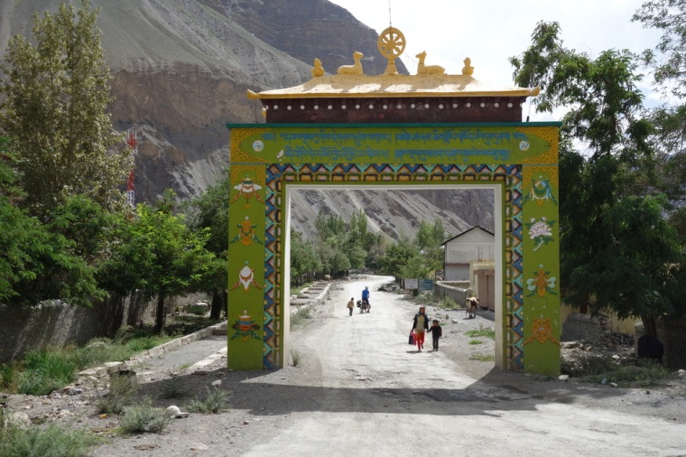
The last 4 km of climbing lent us views of the foreboding Malling Slide, which had been continually blocking the main road for decades, and forced the roadbuilders to make this new route high up to Nako. It might be hard work on a bike, but it meant we got to stay in our favourite place of the trip. Nako is a wonderful, atmospheric village, huddled in a high hollow next to a willow-fringed pond. We explored the steep, narrow stone-paved streets which wind through Tibetan houses where people, goats, cows, chickens, and vegetable plots live squashed together. There is something special about Tibetan villages.
 Nako architecture
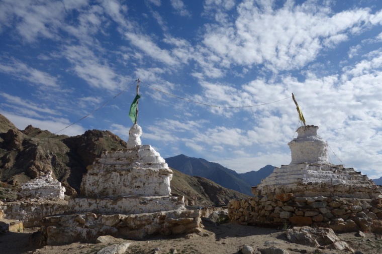 Stupas in Nako
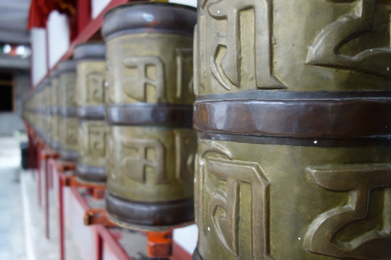
At every turn there seemed to be yet another atmospheric view: blue, white, red, green, yellow player flags fluttering in the strong afternoon wind; houses of stone, wattle and daub, with marigolds and asters bright in the sun; brown-painted woodwork, flat roofs piled with hay and firewood drying in the sun. At every turn there was yet another atmospheric view of a rooftop, or a stupa, or a distant peak. At every corner I had to stop for a few moments to soak up the scene I had stepped into. And then a group of people would pass by, in traditional purple dress, and call out a smiling ‘jule’ as they passed. We were invited into an ancient gompa by a young monk, who told us it was 1100 years old. It looked it. Ancient walls painted with faded thangkas, plaster statues, blackened wood. It was a special place.
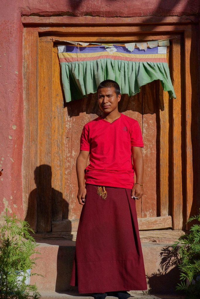 Our Guide
We stayed at the Lovon Hotel which is the first place as you enter Nako. It was 500/- per room which seems to be the going rate in Spiti. There were other choices, but the Lovon is as good as anywhere, and the balcony view was breathtaking. We sat in the rapidly cooling evening air, looking out over an amphitheatre of small fields backed by grey-blue mountains. To the left, the village with its fluttering prayer flags, and to the right, the NH22 cutting a line above the blacks and greys of the Malling Slide. It would be hard to find a better place to be.
 Nako Lake
Day 8: Nako to Tabo
Although Tabo is home to the most famous monastery in Spiti, it was a little disappointing after beautiful Nako. We passed through a painted gate and cycled along the dusty, empty streets leading up to the gompa. There are plenty of guesthouses but not much else to see or do. Even the monastery seemed to lack atmosphere or aesthetic charm; it is rather plain and functional. Inside the 1000-year-old monastery, the walls are covered in famed paintings, but it was hard to appreciate them in the gloom.
 High above the Malling Slide
The day had started with a breakfast of omelette and puffed up Tibetan bread with honey. We needed this nourishment for the hard steep climb up and over the Malling Slide which has destroyed the original road far below. The road was empty of traffic which was all stuck at a new landslip right at the highest point of 3,800 metres. We coasted past and then enjoyed the long winding descent back to the Spiti River. I suffered a headache for a while, but it gradually dissipated as we lost altitude.
 Rock Formations
For the next 15 km, the road follows the river and is all dirt as it is being reconstructed and widened, although it is hard to see why it needs widening when there is so little traffic. It was hot, hard, dusty riding, with several stops to get past bulldozers fighting the landslides. At Sumdo we showed our ILPs one last time and then we were out of the Inner Line. We could start photographing bridges again.
The road to Tabo is a mix of tarmac and dirt; there are many scree slopes pouring on to the road, but by that time we had become inured to the dangers of falling rocks. At the appropriately names Hurling, we stopped at a fly-filled dhaba and cautiously ate chumin noodles for lunch, all the time hoping this wouldn’t be the day we got sick. It really was a poor looking place with none of the charm of other villages in Spiti. We sat outside the dhaba swatting away the flies, surrounded by dirt and litter.
The last 20 km to Tabo were really hot and tiring; our legs were heavy, our bodies weary. The sun was merciless which meant we just had to put our heads down and pedal. It would have been a hard ride anywhere in the world, but at this altitude with loaded bikes on rough roads it really was a slog. There are always days on a cycle tour when it all feels a bit hard; this was one of those days.
 Entering Tabo
Fortunately we found an excellent, peaceful hotel tucked away in the narrow back lanes of Tabo – the Soonan Guest House. It has a relaxing stone-paved garden surrounded with tall flowers, and sheltered from the sun by a huge parachute parasol. To top it all, they had an unexpected treat: excellent espresso! It was a fine place to read, eat, and recover.
 Soonan Guest House
Day 9: Tabo to Dankhar
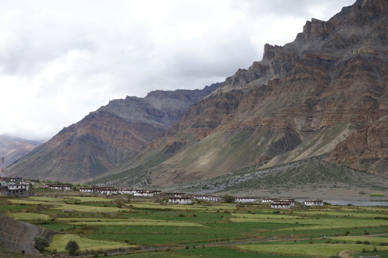
A welcome short day on the bike today – 22 km on the main road to Shichiling, and then 9 km up a steep set of loops to the monastery and village of Dhankar, 420 metres above the valley floor.
The day started well with a fine breakfast of honey porridge and barley flour banana pancakes at the Soonan GH. It was a late start but we knew we only had a short ride ahead of us. We took it slowly up the valley as the road traversed huge scree slopes, sometimes on tarmac, sometimes on dirt; sometimes right next to the gushing mud-laden Spiti, and sometimes higher up the valley side. The two hours’ ride took us through dramatic rock and mud formations, an artist’s palette of rock colours set before an imposing backdrop of snow-capped peaks. Mornings always seem the best time to be on a bike – the air is cool, the wind gentle, and your legs are full of verve.
 Riding up to Dhankar
At Schichling we turned off the main road, under a painted gate, and started the steep zigzag climb up to the monastery. The tarmac was rough but it was a relief after so much dirt, especially on such a steep ascent. Fortunately, the gradient eases off half way up and we could enjoy slowly winding our way closer and closer to Dhankar. The views also helped. At each turn we were offered enticing views of the monastery clinging to rocky pinnacles, inviting us to pedal harder.
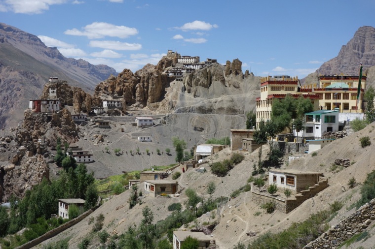 Dhankar
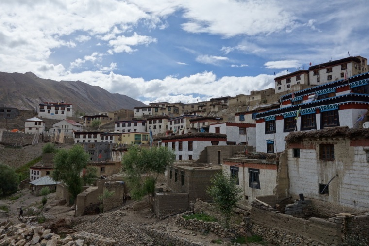
The village is wonderful, perched on a steep amphitheatre with incredible views all around. After a bit of a search, we opted for the Mani Rang Homestay which is a basic, traditional Spitian house clinging to the steep rocky hillside overlooking the whole village. The owner, Amil, is warm and friendly, while his wife is shy and quiet. There is also the grandfather and two children, a boy and a girl. John and I had a spartan room each at the top of the house, which meant we had to descend a steep metal stairway-cum-ladder into the house and to the hole-in-the-floor toilet. It was tricky using it in the middle of the night. The shower was outside the front door, and marginally more luxurious – a bucket of cold water to wash away the road grime. It felt like a proper Spiti experience.
 Mani Rang Homestay
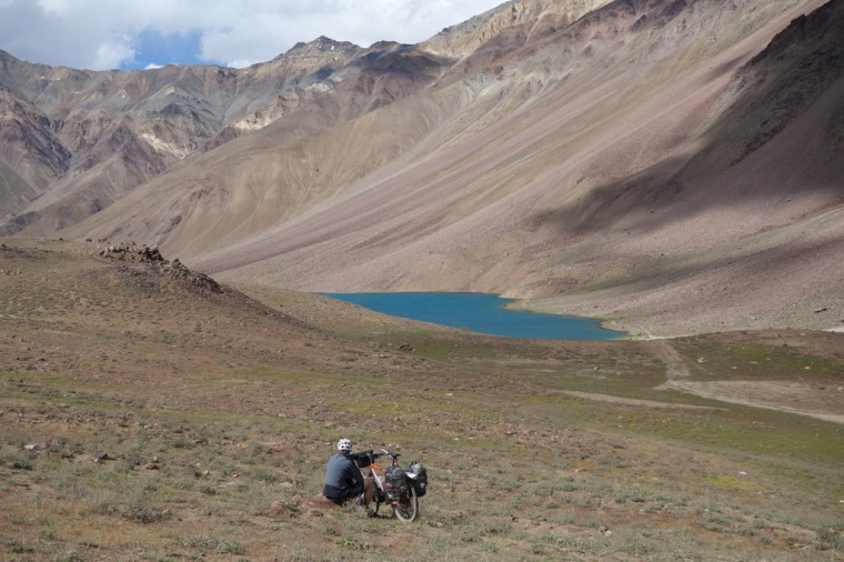
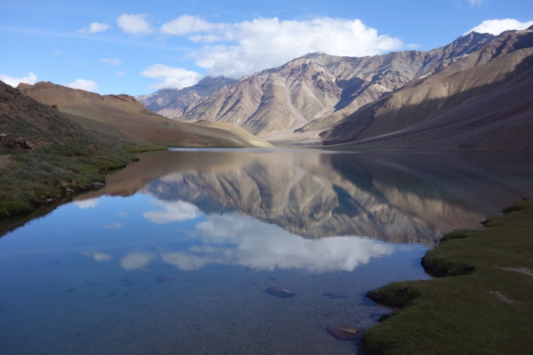
We lunched at the monastery restaurant and then hiked up a steep track in search of the lake we had been recommended back in Recong Peo. It turned out to be a very good suggestion. The small lake sits in a wide hollow at the foot of a scree slope. There is a brightly coloured stupa overlooking the blue-grey water and behind this there are lines of snowy peaks. We spent a couple of relaxing hours, me reading, John dozing, before we decided to take a dip in the cool water.
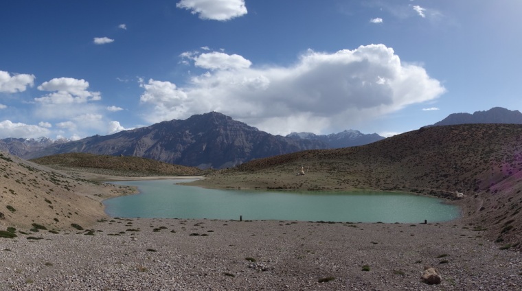 Dhankar Lake
As the sun started to fall behind the mountains we walked back down to Dhankar and were rewarded with National Geographic views of the monastery, village, hazy blue peaks, and braids of the Spiti glistening in the last rays of sunlight. Could we hope for anything better on the trip?
 Returning to Dhankar
Day 10: Dankhar to Kibber Village
Another half day today, if you can call 6 hours in the saddle, riding in sandy dirt tracks and broken asphalt up to 4200 metres a half day. The homestay in Dankhar wasn’t quite what we’d hoped for. A mud-walled room, a hole-in-the-floor for a toilet, used toilet paper filling a cardboard box, no electricity for most of the time, no hot water, and a miniscule thali dinner – all for 600/- each. The main problem was that we were at the mercy of the owners when it came to food; we waited and waited and waited till late in the evening for dinner, and then there was nowhere near enough food to put a dent in our calorie deficit. Food is a big thing when you are burning up so much energy.
 Kaza
Kaza
We left at 6:15 with the aim of cycling in the cool of the morning and getting to Kaza for breakfast. It turned out to be a gruelling three-hour ride as the valley road was loose dust and rocks for much of the way. On an empty stomach, compounded by a poor dinner, I felt very sluggish. Things improved at Kaza, though. We found an excellent little restaurant, Volmo Food Corner, on the main street through the village, where I had a no-holds-barred breakfast of porridge with bananas and honey, pancake with the same (the best I have ever tasted), and an onion and garlic omelette, all followed by one cup of steaming chai, and two cups of black tea. That knocked things back into equilibrium.
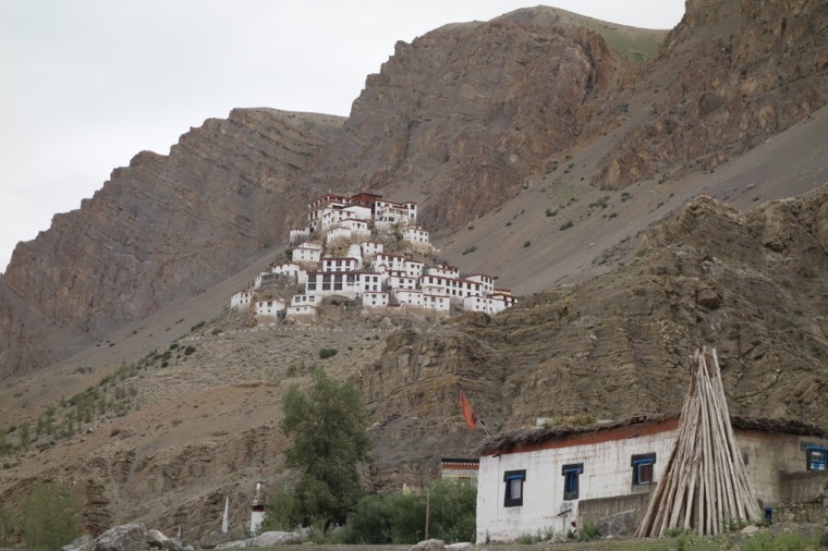 Ki Gompa
Revived, we headed up the valley to Rangrik Bridge where we turned right on to the Kibber road. After a few kilometres, Ki Gompa came into view, perched on a rocky pinnacle. It had been cool and overcast all morning, and once we were on the tarmac to Kibber it started spitting with rain. Bands of rain were falling on the far side of the river, but we missed the worst of it. Just near the top of the zigzags we finally donned Goretex jackets.
 Kibber Village
Kibber is another scenic village, but much more solid-looking than vulnerable Dankhar. The houses are very Tibetan, with white-painted stone walls, brown-framed windows with the distinctive trapezoid shape formed by the black-painted surroundings. The houses are capped with flat roofs and white-painted joist ends, and atop all this piles of firewood and hay drying in the sun. Like Dankhar, the village is in a natural amphitheatre, but the slope is much kinder.
We stayed at the Nurling Guesthouse which is luxurious compared to the homestay in Dankhar. There is a wide balcony overlooking the village and a constant supply of tea and coffee from the attentive host. It was a great spot to wash, launder and recuperate.
In the afternoon, I went for a walk around the village, snapping away at the highly photogenic architecture and the dramatic rainclouds looming behind. Walking up past a small monastery, I was invited in by a very cheerful monk who enthusiastically showed me the gompa and actually encouraged me to take photos. He banged a drum, blew a long horn, and made sweet butter tea. It was one of those experiences that you know will stay with you. Later, I met John higher up the hill by a waterfall, where I dozed in the brief sunshine with the sound of tumbling water soothing me.
In the evening, we sat on the balcony as the light faded, enjoying Indian whisky and French cashews. At dusk, the village’s cattle were brought back down from the high pastures, lines of goats, sheep, donkeys, mules, cows – a biblical stream of beasts flowing down from the ridge and dividing into rivulets that headed to each house. The animals clearly knew where to go as they each stood by a house and waited for the owner to put them away for the night. And then from nowhere, a bus appeared over the ridge on a precarious track and rattled on down the road to Kaza. The differentness of life here is astounding.
Day 11: Kibber Village to Losar
I’m sitting on the north-facing veranda of the Tashi Gatsel Guest House looking out over the fields of Losar and the upper reaches of the Spiti Valley. It’s in the shade, very windy, and surprisingly cold. I’m wearing every item of clothing I brought. Yet again, the view is magnificent.
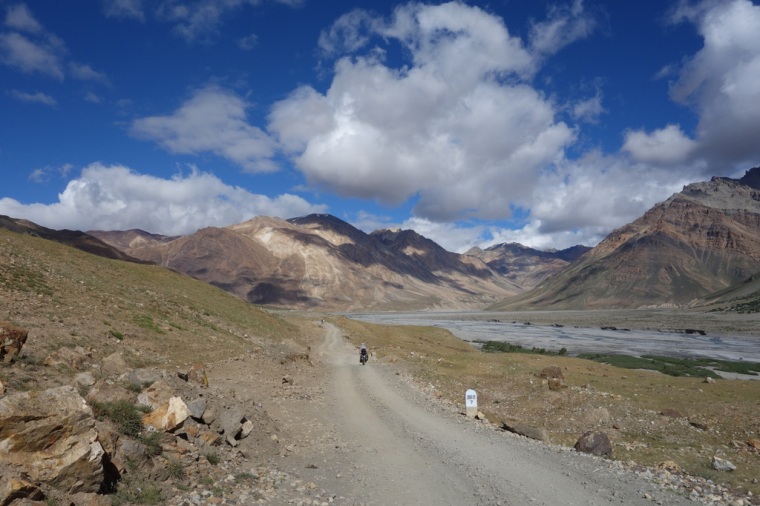
We left Kibber at 8 a.m. after another excellent breakfast of banana-honey porridge and omelette. We took with us toast and jam made by the hotel which we ate for lunch. The food of champions. It was another overcast, showery day, so riding down from Kibber to the valley was mighty chilly, but the 17 km soon passed and we were back on the main road heading up towards the head of the Spiti Valley.
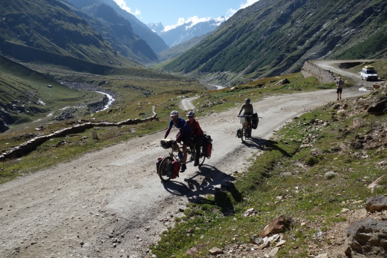
There are lots of small villages along the way, each built on a tributary flowing down from unseen glaciers and snow fields. The first half of the route was easy going on broken tarmac and occasional dirt. At a couple of points we zigzagged into the mountains to negotiate tributaries that cut deep gullies into the rock. It was all fantastic, huge scenery with different colours everywhere. After Kiato, the road deteriorates, so the last 15 or 20 km were hard going on poor surfaces. There we met a Punjabi lad riding a mountain bike from Manali to Kaza, with just one backpack strapped to a seatpost rack and another on his back. The only other thing he had was a large, heavy track pump strapped to the rack. It was impressive that he’d made it so far on his own with such basic gear.
 The Stunning Spiti Valley
Before Hansa, the valley broadens and reveals some of the most beautiful scenery I’ve ever seen. We cruised slowly along the last of the tarmac soaking in the stunning sights. At times I was compelled to stop as the landscape was too beautiful to ride through; it need a few moments to savour and imprint on my memory for the years ahead.
Beyond Hansa, it started to rain quite heavily for a while so we just put down our heads and cranked our way up the bumpy track that calls itself the main road. It felt like a foretaste of what we knew awaited us in the next three days. After what felt like an eternity, we finally arrived in Losar at 2:30 just as a famous Lama was about to arrive. The steep road up to the monastery was lined with local people in traditional dress, eagerly awaiting his arrival. And then he arrived in a long convoy of 4x4s which tried to negotiate the bend into the monastery gate. We hadn’t helped as we’d leaned our bikes on the wall opposite the gate. As the second 4×4 reversed back to try to make it into the gate, it very nearly crushed my poor bike. It was only saved by the shouting and waving of the crowd; it would have been an unlikely end to the trip – my bike crushed by a reversing Lama.
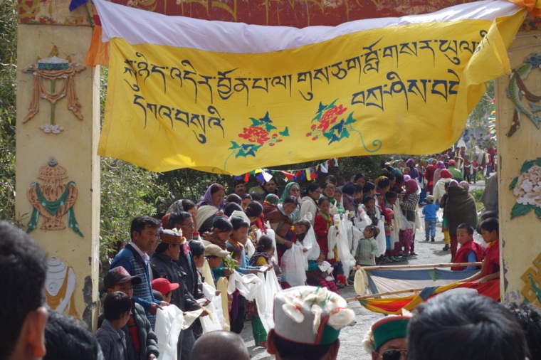 Welcome for Lama
 Losar
Losar
Losar is a basic kind of place as well it might be right at the end of this inaccessible valley. The recommended guesthouse, the Samsong, was a bit too grubby for us, even after becoming accustomed to basic Spitian accommodation. Fortunately, the Tashi Gatsel is much better, and the lunch of aloo mattar, mixed veg, and biryani was first class. After dinner, we persuaded the cook to get up early to prepare a huge breakfast for us to propel us up the mighty Kunzam La.
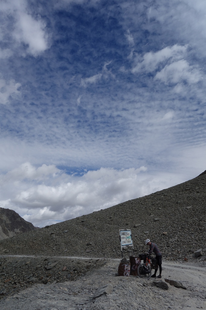
Day 12: Losar to Chandra Tal, over the Kunzam La
 The Upper Spiti Valley
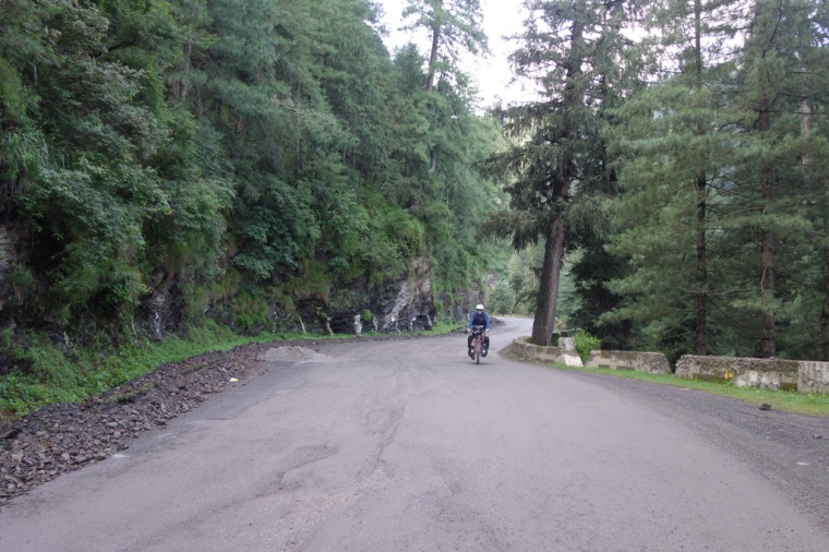
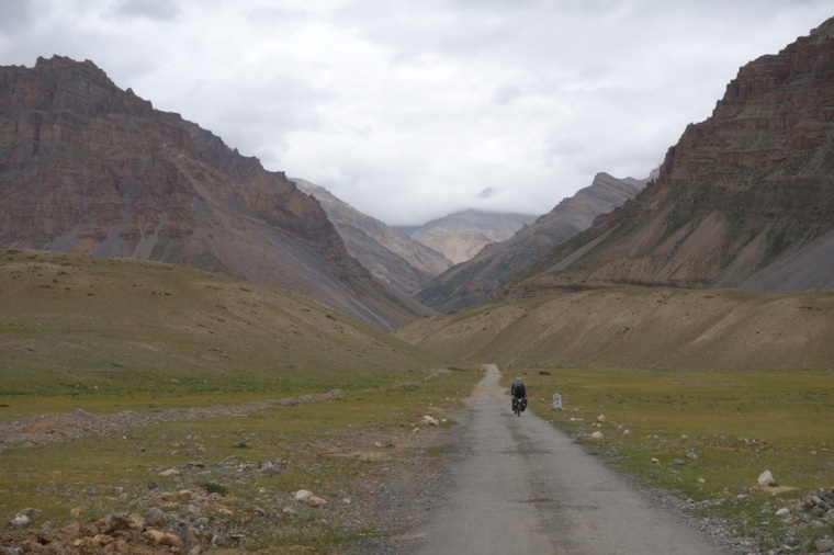
We started the day fuelled up with another good breakfast – one of the many pleasures of Spiti – milky porridge and pancakes, before setting off for the Kunzam-la 17 km away. It was a bright sunny morning with our first real headwind of the trip, which would add to the rigours of the climb. The first part runs through the head of the Spiti Valley, a truly beautiful place. Despite the big climb ahead, or perhaps because of it, we stopped frequently to soak up the last of this beautiful valley.
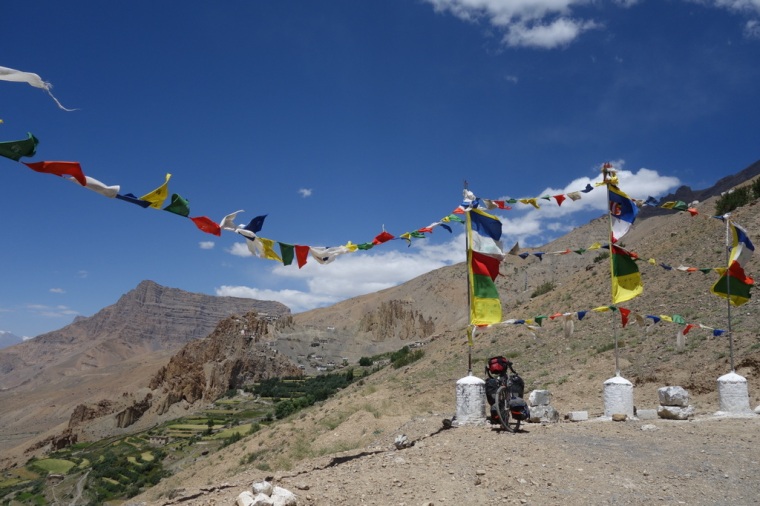
The real climb starts with a few long, rough zigzags, but the gradient is manageable. It then levels off before hitting a second long traversing climb to a stupa. The final climb winds up to the pass which is broad and flat and very windy. The pass itself is just below the road and reached by a straight track lined with furiously flapping prayer flags. At the end, four stupas stand swathed in thousands more prayer flags. It is fine place.
 Approaching the pass (photo JBL)
 Kunzam-la, 4501 metres
The chilly wind forced us to leave the pass and head down in search of somewhere more sheltered. After a few hundred metres we met a German couple in their 60s who looked suitably pooped from their massive climb up atrocious rocky roads. Again we felt happy to be going anticlockwise as our climb had seemed quite easy in comparison to the side we were descending. Coincidentally, the Germans had also done Manali to Leh in 2012.
 Riding up to Chandra Tal
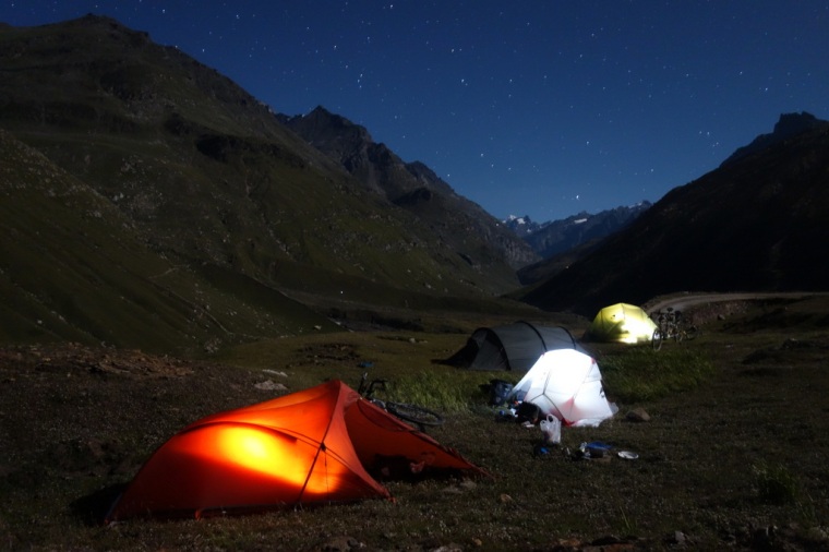
It really was a bumpy descent to the Chandra Tal turn off and it wasn’t helped by a fierce headwind. Near the turn off, we got views of the Chandra Tal track climbing up above the Chandra River. It gave me second thoughts about whether it was worth riding 14 km up a track to see a lake. Fortunately, John was still keen, so after our lunch of toast and jam prepared by the Tashi Gatsel, we slowly rode up and down, up and up to the lake. We crossed two long, deep, tricky fords and at the second filled up the water bag in preparation for our first night beneath the stars.
 Riding up by the Chandra River
The campsites are a few kilometres below the lake, and although they look nice enough, we decided to continue up yet more zigzags to see if we could camp nearer the lake. It was a good decision. After a tough, steep climb to the lake car park, we pushed our bikes up and over a ridge to find a great spot, partly sheltered by a rock outcrop. The panoramic views were stunning: peaks, glaciers, rivers, valleys, ponds. One of the best places I’ve ever camped.
 Chandra Tal
We cooked pasta, garlic, anchovies, dried porcini, dried tomatoes and tomato soup; it tasted delicious, which was surely due more to the situation than the cooking. As it was getting dark, a herd of horses appeared out of the gloom and hung around companionably for a while.
It was cold. Too cold to stay long outdoors, despite the stars, so I went to bed at 8:30. In the night, I woke up and left the tent for a pee and checked my watch to see if it was soon time to get up. It was only 11:30.
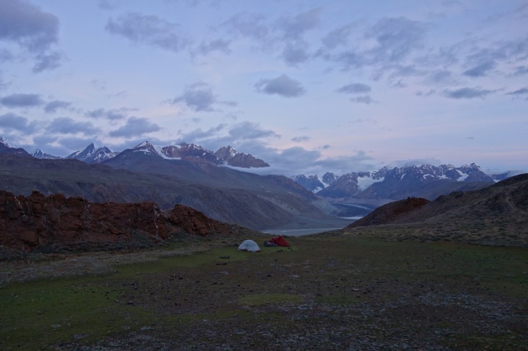 Campsite with a View
Day 13: Kunzam La to Grampoo
It had been a restless night with me sleeping an hour, waking, dropping off, waking again. The clear sky brought with it freezing temperatures which meant my +2C rated sleeping bag was right at its -4C limit. I got up at dawn to find ice on the tent and the first rays of light touching the peaks above the nearby glacier. It was a clear morning which made us hopeful for the bumpy day ahead.
 Early Morning, Chandra Tal
After a breakfast of muesli and powdered milk brought from Japan, we walked our bikes down to the Chandra Tal. It’s a beautiful, crystal clear, turquoise lake. We cycled to the end of the lake where a few hardy tourists were already arriving to break the tranquillity. But nothing could deter from the astonishing view of the mountains reflected in the still water.
 Mackerel skies
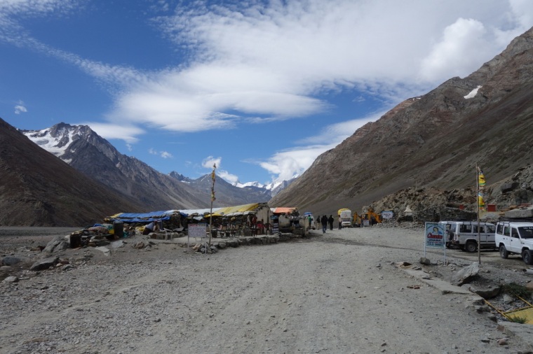 Dharbas at Batal
The 14 km ride back to the main road passed quickly enough, although this time we both got our feet wet in the biggest ford. At Batal, we had chai and oily aloo parantha as a mid-morning snack. The owners of the dharba were very friendly and showed us newspaper cuttings explaining their heroism when they saved a large number of people trapped for ten days by a snowstorm.
 Rough roads
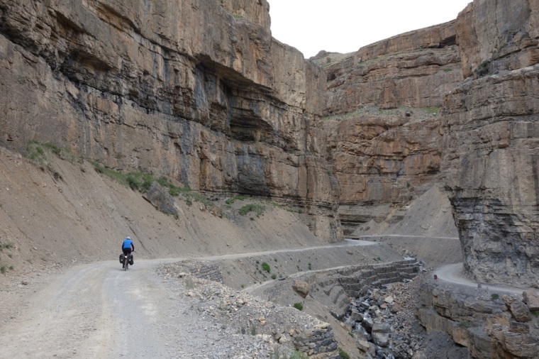
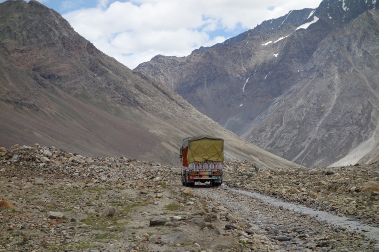
From Batal to Chhatru the road is as bad as it is possible for a road to be before you simply call it a valley floor. We had been promised a rough ride, but at times I felt we were trying to ride along a rocky river bed, which in places we were. For several hours we bumped and bounced our way up and down, sometimes near the river, sometimes up above it. Occasionally, it was hard to know whether we were still on the road, but despite all this it was great. I felt like I was on a challenging mountain bike trail with the added difficulty of 25 kilos of luggage. And the added sound effects of the rushing, roaring Chandra River.
We had planned to have lunch at Chhota Dara, but we arrived to find it deserted. We regretted only having a snack at Batal as the next village was hours away at Chhatru. To add to the adventure, it started to rain heavily which meant we arrived at the grim dhabas not just hungry, but also drenched and filthy. It would have been nice to warm up inside, but that would have meant sharing the grungy space with worryingly drunk truck drivers lunching on whisky. Still, we enjoyed our fiery spicy thalis beneath a dripping parachute.
From Chhatru to Grampoo the track improves somewhat, although it is still very bumpy in places. It also rises high above the valley floor and then plunges back to the river….three or four times. Just what you need at the end of a hard day of riding. But the rain had stopped, the wind died down, and nothing was going to stop us enjoying this magnificent place.
Just before Grampoo, we found a likely looking campsite in a loop in the road climbing up to the Rohtang-la road. It was an unlikely spot but actually very beautiful. As we were moving rocks and preparing to put up our tents, a very unlikely sight appeared from the direction of Grampoo – a tandem together with a solo bike. It turned out to be Marcus and Kirsty from Bristol who had ridden all the way across Europe and Central Asia, and Tara from Canada who had been on her bike for 18 months. It put our humble trip into perspective. Marcus and I talked about running and triathlon and cycle touring and their hopes of visiting Japan. Big world, small world.
 Camping in Grampoo
The night was crystal clear which brought out a myriad stars. We perched our cameras on rocks and took long exposures of the night sky and mountains and tents. It reminded me of camping at Snow Lake back in 1992. The main difference was the trucks which occasionally passed nearby, their headlight swinging across the campsite. I wondered whether they too had lunched on whisky.
Day 14: Gramphoo to Manali
 Marcus, Kirsty and Tara heading off
Having ridden the Rohtang La in the opposite direction three years before, we expected a big, tough day ahead. The sting in the tail of our tour. We waved goodbye to Marcus & Kirsty and Tara and headed up the Rohtang in brilliant sunshine. We were in no hurry as we knew this was our last chance to soak up the Himalayan scenery, and we wanted to pace ourselves up the big climb. After all our fears of rain and mud and a terrible surface to ride on – or rather walk, as we had expected – we instead found hard-packed mud, often smooth, little traffic, and breathtaking views. Three years ago we had descended in heavy rain, with rivers of mud winding their way around our bikes, gouging our brakes and rims, and nothing to see but clouds. Another twenty-two years before that, I had descended in a cramped, bouncing bus and failed to see the drama of the green hills of Himachal giving way to the arid slopes and snowy peaks of Zanskar. This time we soaked it up, stopping frequently to stare at the splendour and delay the inevitable end of the trip.
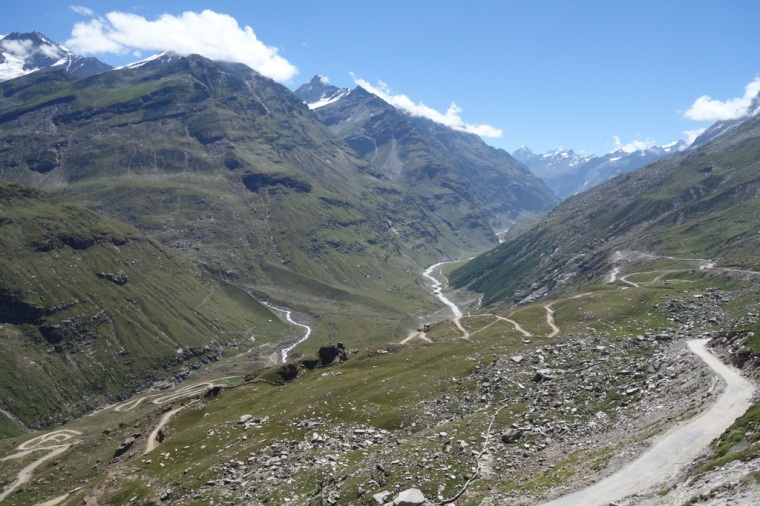 The north side of the Rohtang
The two-and-a-half hour climb was over much too soon. We arrived at the cairns and prayer flags of the Rohtang-la and took pictures and videos. Three years ago we had completely missed the pass due to the monsoonal rain; this time we luxuriated in the sunshine and the knowledge that we now had 50 km of descent ahead of us.
 Rohtang-la
The descent is just as good as the ascent but dramatically different. The north side is arid; the south is alpine green with towering firs, snow-filled gullies, and free-falling waterfalls. We seemed to descend for ever, looking all around and sucking up the spectacle. We passed white horses, long-horned cows, swaying buffalo, melting glaciers and flower-filled pastures. At Marrhi we stopped at the same dharba as three years earlier, drank the same Limca and ate the same aloo mattar. But this time we were in shorts and t-shirts and thrilled from our trip, rather than fearful of the massive passes that lay ahead.
 The sudden shock of greenery – south of the Rohtang-la
From Marrhi we wound our way through the gorgeous alpine forests that lead down to the River Beas. Before we knew it, we were dodging in and out of auto rickshaws, taxis, trucks and cows. We were back in India.
 The Beas Valley
Manali was yet another culture shock. Travellers of all varieties lope up and down the streets, in and out of shops. I felt like an alien. The final climb up to Old Manali was just as steep as I remembered and feared, but with 4500 metres of altitude in our blood, we surged up the impossibly steep narrow streets to the Himalaya Guest House. We’d done it. After all the planning and preparation and effort, the trip was over.
Back to Delhi
 Old Manali
We spent a day in Manali ordering a taxi, obtaining bike boxes and packing. I even managed to get a full bells-and-whistles shave and facial reworking. John discovered a cycle shop which had proper mountain bikes, and more importantly, empty bike boxes available for a small sum. Despite having posted our old boxes from Shimla to our hotel in Chandigarh, we decided to get the boxes and pack our bikes while we had plenty of time. We also phoned Devanshe’s father who had a taxi sent from Chandigarh to pick us up. He wasn’t the best driver, but he got us to Chandigarh safely, if a little stressed. John had booked us into a very luxurious hotel where we made the transition from travellers to Westerners. We had a few hours to burn, so we walked half an hour to the Rose Garden. It is a tranquil place, and I even managed a 10k run in the sweltering heat. Later, we went out in search of a decent restaurant, something which is hard to do in spread-out Chandigarh. With an incredible bit of luck, we found a restaurant that Mike and Devanshe had taken us to 5 years earlier. In a huge place like Chandigarh, it seemed amazing to chance upon the same restaurant.
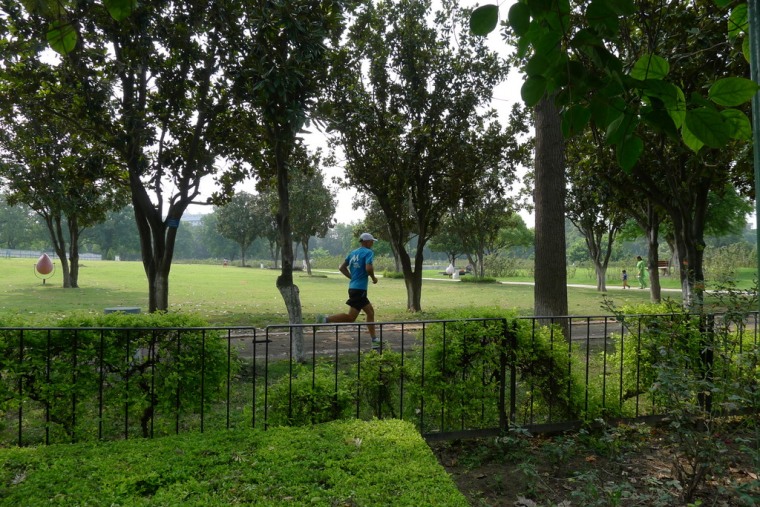 Running in the Rose Garden, Chandigarh (photo JBL)
Next day we got a taxi to the station, the train to Delhi and then we were back in the Ajanta Hotel for one final night. We had phoned ahead to the hotel to ask for a couple of staff to meet us off the train and help with our bike boxes. The Ajanta seems always to be reliable, as the men were waiting as our train stopped. After decades of travelling the hard way, it is good to plan things a little and save a lot of grief. Continue reading “Spiti Valley Cycle Tour 2015”
