
![]()
I almost didn’t do the “Orange Marathon” 10 km running race in Yugawara this year. Youri had pulled out due to injury, so I didn’t want to go all that way on my own. Fortunately, I remembered in time that Matt from work had also signed up which gave me the motivation to take an early train westwards around the Shonan Coast to the spa town of Yugawara. I took my road bike with a vague plan to ride over the hills to Hakone and back to Tsurumaki Onsen.
I had done the race previously in the rain, but this time the weather was perfect – mild and sunny. I cycled from the station to Yugawara Elementary School which is the base for the run. It is a big event, with several thousand participants, so the school was packed with runners and volunteers. I met Matt and we prepared for the start.
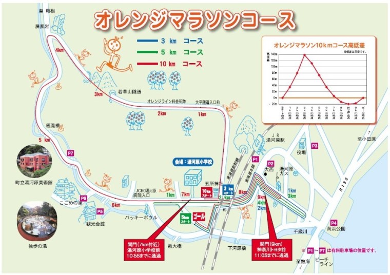
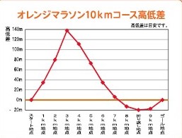
The race is a squashed loop which climbs steeply up the Orange Line road for 3 km to a height of about 160 metres, and then down to the Chitose River which it follows back down to the elementary school. It continues down to the sea before doubling back uphill to the finish in front of the school. Up, down, and up again – not an easy course.
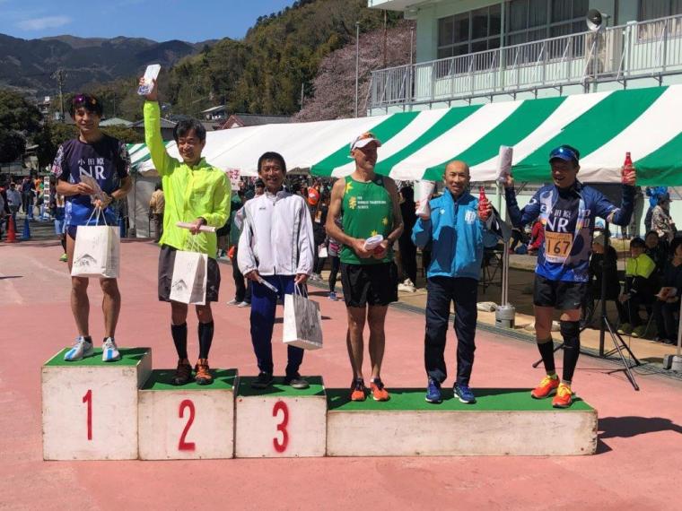
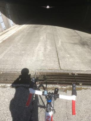
I started in the second block for a target time of 36 to 40 minutes, but soon started passing lots of people as we hit the steep climb up the Orange Line. It is a long three kilometres to the top through a couple of tunnels and over a few false flats. By the time we had descended the kilometre to the river, the places had mostly been decided, so all that was left was to hang on for 6 kilometres. The descent was hard on the thighs, but it is great running down through the town with its old spa hotels and shops. The support is good and the atmosphere festive. I tried to leave a bit in the tank for the last two kilometres up to the finish, but I did get passed by a couple of people with a little more left than me. I finished a minute slower than three years previously, but I had done little running for 6 weeks due to an ankle injury. Matt sprinted over the line a little while later with a big smile on his face. I received a t-shirt, a bottle of Mt. Fuji Coca Cola, and a place on the podium for 4th out of 260 in the over 50s.
After the race, I changed into cycle gear and headed back up the running course in the direction of Hakone, 800 metres above. It’s an excellent ride which basically follows Route 75 all the way to the far side of Hakone. At first you keep to the river, and then once you leave the spa town behind, the road turns right on to the Tsubaki Line. This road winds up through mixed forests with the occasional mountain cherry in full bloom.
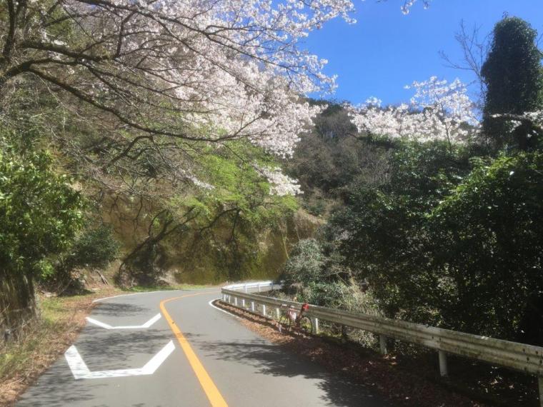 Cherry blossoms at the foot of Route 75
At times you get splendid views across Sagami Bay to Oshima island. The only downside was the groups of motorcyclists passing too fast and too close and shattering the mountain quiet with their pathetically noisy machines.


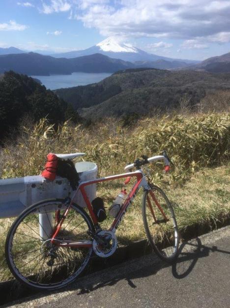
At the top, I put on a jacket, crossed under Route 1, and continued steeply down to Lake Ashi (Ashi-no-ko). The views across the lake to Mt. Fuji were stunning. The last time I visited Ashi-no-ko was in 1994 with my mother and sisters. We had walked all the way around one side of the lake on a hiking path, and then taken the cable car up the volcano to see the steam vents. I remembered it as a cold, lifeless place where we had difficulty finding somewhere to eat. 25 years on it has been transformed by tourism. Crowds of foreign tourists filled every attraction and the road was jammed with traffic. I cycled up the inside of the cars for a couple of kilometres and then headed north-west up the surprisingly quiet lakeside road.
A couple of kilometres later, I zigzagged up and away from the lake to pick up Route 75 again. People must like sitting in traffic jams, as the 75 had little traffic on it. I continued up to the north end of the lake where more tourists thronged the souvenir shops and cable car station. They need to get on bicycles; as soon as I rode away from the lake, I returned to quiet roads and tranquil scenery.
At Route138, I followed the main road for a couple of kilometres and then headed up the forest road which serves Mt. Kintoki. It is a quiet road which provides a short cut over the mountain, through a tunnel, and down the other side where it picks up Route 78 to Minami-Ashigara. My plans to ride all the way to Tsurumaki Onsen were foiled by the approach of evening, as well as a warm convenience store with hot coffee and comfortable chairs. I packed my bike into its rinko bag and took the train from Kaisei station.
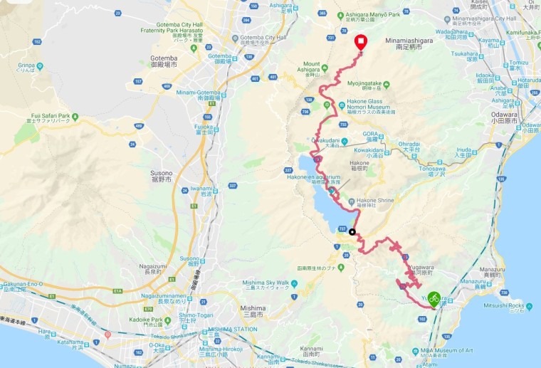 Bike route
